Removing the wilding pines from the Catchpool Valley, Remutaka Forest Park
The infestation of wilding pines in the Catchpool Valley, Remutaka Forest Park is finally being removed!
As before, the plan is to revegetate the slopes above the Catchpool Stream and our wetlands restoration zone with native trees and eco-sourced plants to restore habitat and landscape stability.
This was once a magnificent rimu/ rata forest, with a significant lowland broadleaf component - and ideal habitat for the huia and many other native species that flourished there before the arrival of humans - and their myriad of introduced plant and animal pests - to Aotearoa.
The Department of Conservation (DOC) secured funding for the treatment and removal of the wilding pines and for the harvesting of the small remnant mature pines plantation that escaped the original pine forest clearance.
For the past 11 years, volunteers from the Remutaka Conservation Trust - with help from hundreds of corporate volunteers and thousands of school students - have hand-pulled countless Pinus radiata seedlings and cut-and-poisoned thousands of larger wilding pines from the most accessible lower slopes and valley restoration sites, but we simply could not keep up with the relentless tide of wildings emerging on the steep slopes above.
Once again, the hillsides above the valley on the clearance site will look dreadful for a few more years, following aerial spraying, clear-felling, and basal-bark drilling treatment of the wilding pines.
The good news is that there remains a significant reservoir of seeds in the remnants of the original native forest in some of the gullies up there that we will collect to grow in our nursery for our reforestation efforts over the next decade or two.
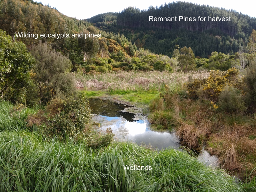
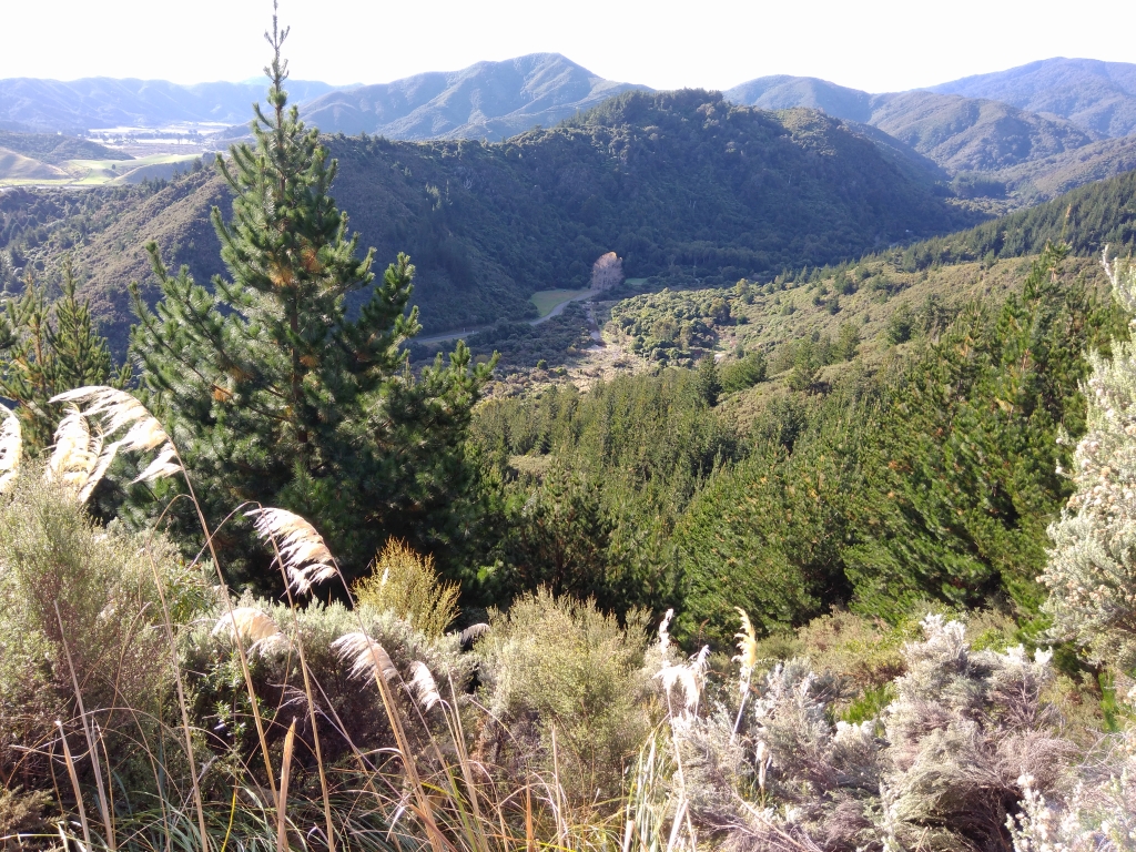
Photo of the remaining plantation pines that will be harvested taken from the wetlands restoration zone. Also shown are the wilding pines, gum trees and acacia that will be controlled this year. (Photo credit: PC.)
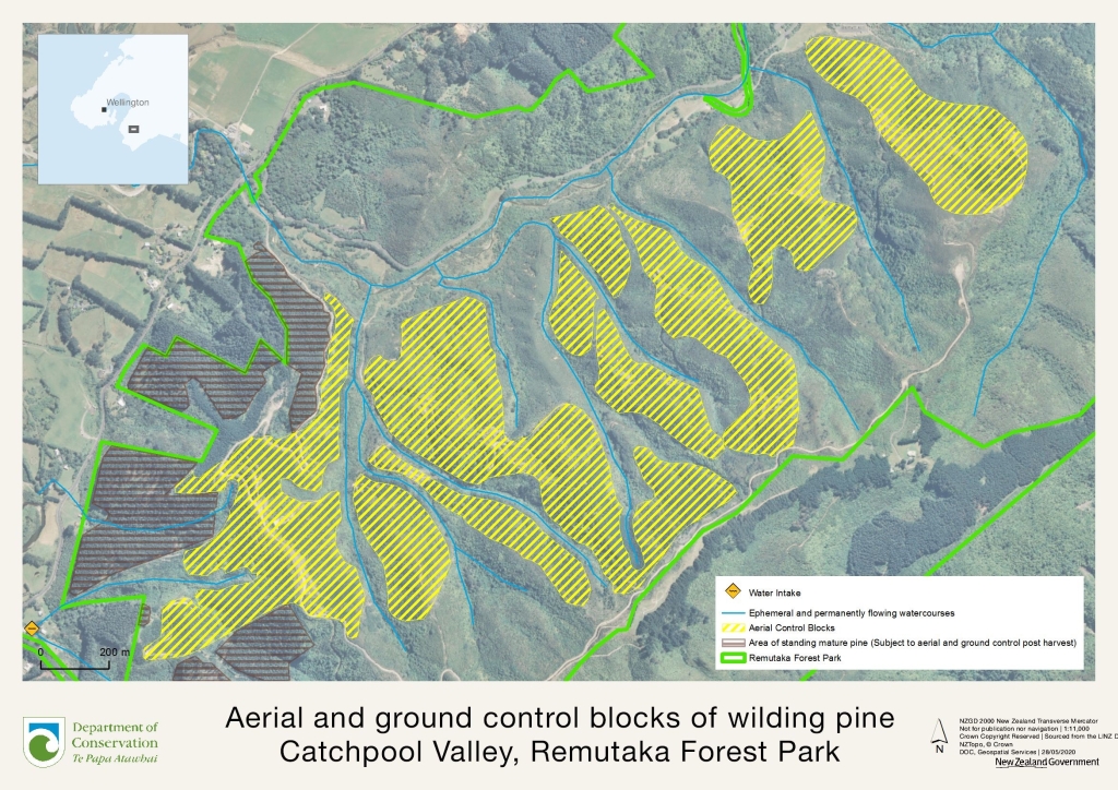
Map of the southern section of Remutaka Forest Park showing the aerial and ground control blocks being treated to remove wilding pines and other exotic trees. These areas will eventually be replanted with native trees to restore the forest and landscape to provide better habitat for native species. It will also create a better first-impression of the Park entrance for visitors when eventually restored to permanent native forests. Click image for a larger view. (Map credit: Angus Hulme-Moir, DOC).
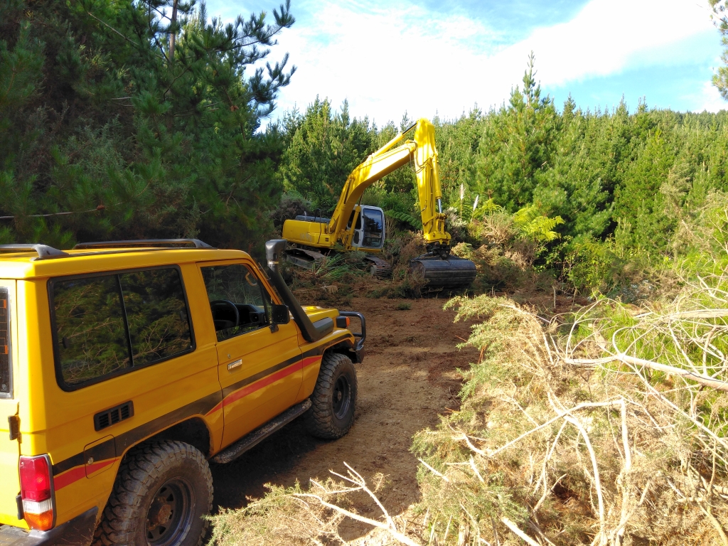
Contractor's excavator and 4WD in action building a new access road for ground control contractors. This road goes off our wetlands access road on the valley floor and up to, then along, the 200 metre contour above the DOC campgrounds. Note the density of the wildings at this location! (Photo credit: PC).
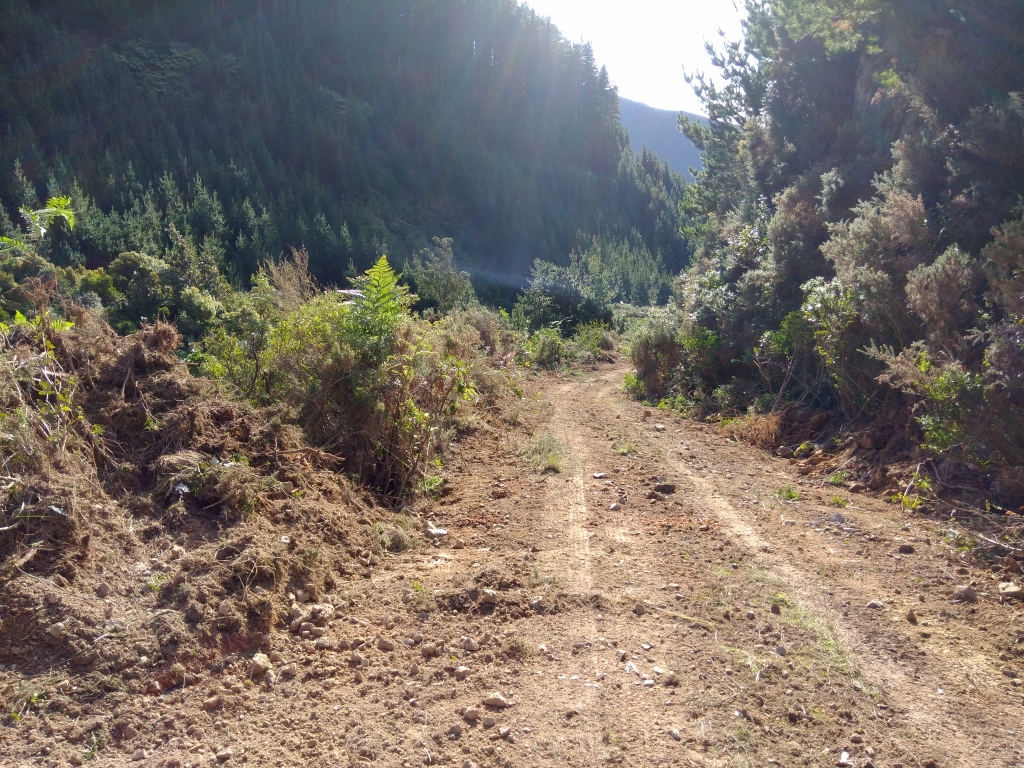
View looking back down the new access road across the gully towards the remaining stand of pines that will be harvested. There's lots of remnant native bush down in the stream below which will become a seedbank for future reforestation of the hillside slopes. (Photo credit: PC).
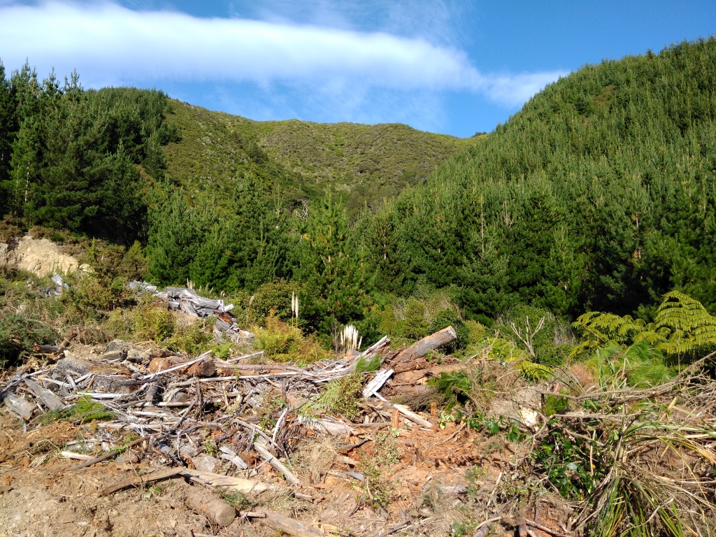
This photo looks up the hill from the new access road towards the old logging road at the top of the hill. Notice the extensive coverage of wilding pines on both sides of the gully. Interestingly, the area in the centre-distance that was aerially-sprayed by helicopter with a herbicide specific to wilding pines 12 years or more ago remains clear of wildings and shows regenerating natives. Photo credit: PC.
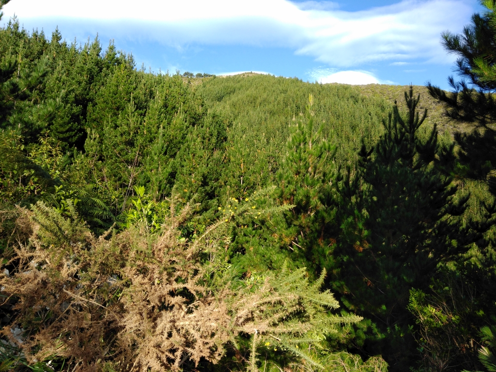
Here's a view of the dense growth of wildings that will be sprayed by helicopter to suppress their growth and allow us to restore native forest to this site eventually.
View of the Catchpool Valley from the new access road. The path was cleared to enable ground-control contractors to work on removal of the wilding pines on the slopes above the DOC campsite and our wetlands restoration zone. Click for a larger image. (Photo credit: PC).
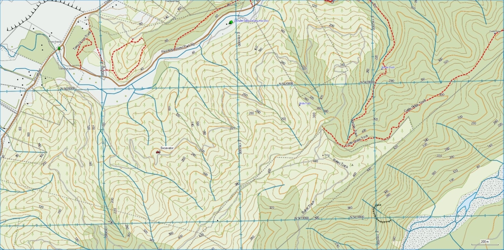
Map of the old logging access track I prepared for the excavator contractor to show the original path along the 200 metre contour line on the hillside above the Catchpool Valley entrance to the Remutaka Forest Park. It rises up from the road along the foot of the hill that he cut for us last year to provide easier access to our wetlands restoration zone on the valley floor. He subsequently cut a new 5m wide road along most of that 200m contour. Excavator icon shows the location where we parked the digger overnight on the first day of operations. (Click for a larger map). Below is an historic satellite map of the same area.
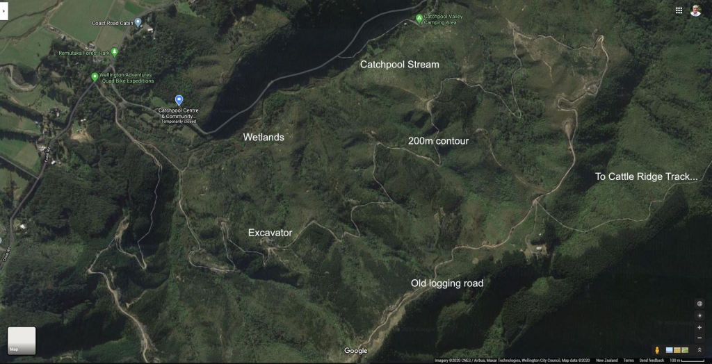
Satellite map of the restoration zone showing the path to be excavated along the 200m contour line. (Click for a larger map). This new pathway will provide easier access for the ground control operations conducted by contractors hired to treat the wilding pines that are not in the blocks which will be aerially-sprayed.
These new access pathways will subsequently be used by our Remutaka Conservation Trust volunteers in future years to revegetate the entire hillside again with native trees and plants and to conduct invasive-pest control operations.


